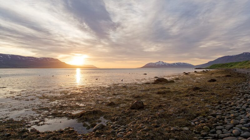
Northeast Iceland, known as Norðurland eystra in Icelandic, covers a vast area in the northern part of the country. It is one of Iceland’s traditional eight regions. With its mix of active volcanoes, glaciers, fjords, thriving towns, and remote villages, the region provides insight into how Icelanders have adapted to living close to the Arctic Circle, with traces of settlement going back to the earliest Norse arrivals.
Geography and population of Norðurland eystra
Norðurland eystra encompasses 21,968 km² in north Iceland. The population was 29,361 in previous government tallies and around 30,600 in 2020, while census records cite 32,296 residents in 2026. Agriculture, fishing and local industry persist across towns and fishing villages, with urban life most evident in Akureyri and several other regional centres. The region extends from the Tröllaskagi peninsula in the west to the remote valleys and coasts of the east.
Akureyri, the largest town outside the capital area, is the main hub in Northeast Iceland. As of 2026, its population exceeds 20,000. The port remains ice-free during winter, making it historically significant for trade and naval access. Akureyri’s relatively mild and stable climate allows for outdoor gardens despite being near the Arctic Circle.
Towns, villages and islands
Húsavík, set on the northeast shore of Skjálfandi bay, has a population of 2,485. Norse settlement began here around 870 AD, with Garðar Svavarsson credited as the first settler. The town’s wooden church, Húsavíkurkirkja, was built in 1907. Húsavík is also home to the Húsavík Whale Museum, which moved in 2002 to a former slaughterhouse and contains skeletons of nine whale species, among them the narwhal and orca. The Exploration Museum, likewise in Húsavík, is dedicated to Icelandic and international explorations and chronicles Apollo astronauts’ training in the area in the 1960s.
Grímsey represents Iceland’s northernmost community, crossing the Arctic Circle. Its only inhabited settlement, Sandvík, had 57 residents in 2021. The island draws large seasonal colonies of puffins, kittiwakes and auks.
Dalvík, on the western shore of Eyjafjörður at the entrance to Svarfaðardalur valley, remains rooted in fishing and fish-processing. It also acts as a harbour connecting the mainland to Grímsey. Dalvíkurbyggð municipality, formed by merging Dalvík, Svarfaðardalur and Árskógur in 1998, covers much of the Tröllaskagi peninsula. Dalvík’s Fiskidagurinn mikli fish festival has brought tens of thousands for well-known free seafood events.
Siglufjörður, once Iceland’s leading herring port, saw its population reach about 3,000 in 1950 but is now about 1,165. The town boomed during the herring era before the industry’s decline in the 1960s. Its history is examined in the Herring Era Museum, which opened in 1994 and explores Siglufjörður’s maritime legacy.
Reykjahlíð is recognized as the highest village in Iceland at 292 metres above sea level. In 1729, lava from Krafla volcano destroyed the town but left the church standing, attributed to the prayers of the local priest. The 2021 population was 227.
Kópasker, with 117 inhabitants recorded in January 2024, relies mainly on lamb processing at Fjallalamb. The settlement was hit by a significant earthquake in 1976, reaching a magnitude of 6.3.
Bakkafjörður, with 72 residents, began as a farming settlement. Its most prominent 19th-century farm was Höfn. Halldórshús, the merchant’s house built in 1900, is still noted for its commercial history.
Waterfalls, glaciers and natural features
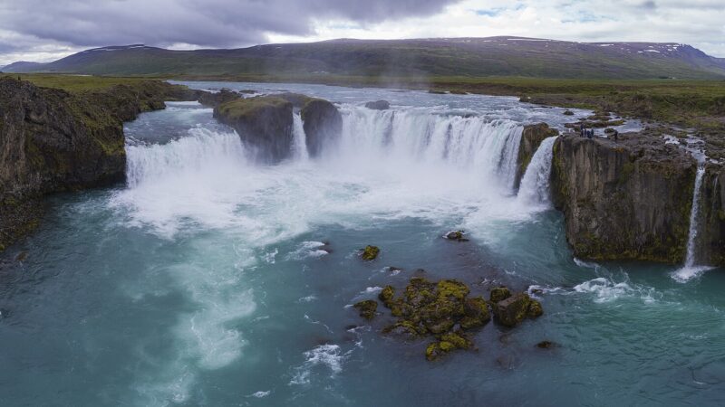
Dettifoss is among Europe’s most powerful waterfalls and is the second largest in Iceland by water volume. It is 44 metres tall and 100 metres wide, its waters carrying glacial sediments that lend it a greyish white colour. Goðafoss, situated on the Skjálfandafljót river near the Ring Road, ranges from 9 to 17 meters in height and about 30 meters across. Its name is connected either to gods or to the actions of a chieftain, with the precise origin uncertain.
The Vatnajökull glacier, which is partly within Southeast Iceland but extends into the Northeast, is the second largest ice cap in Europe by both area and volume, covering about 7,700 km² and representing about 8 percent of Iceland’s landmass. Its ice reaches an average thickness of 380 meters, with some spots as deep as 950 meters.
Tungnafellsjökull, another glacier and central volcano, rises to about 1,540 metres and covers 48 square kilometres. It contains two calderas, one of which is geothermally active. Its most recent lava is estimated to be less than 4,500 years old.
Mountains, valleys, and lava formations give the landscape its distinctive character. Bárðarbunga, the country’s second highest mountain, reaches 2,000 metres and sits beneath up to 850 metres of ice. Its associated volcanic system stretches over a length of roughly 190 kilometres. Krafla volcano boasts a caldera some 10 kilometres wide with a 90 kilometre-long fissure zone, and has seen 29 eruptions in recorded history. Herðubreið is a tuya, its table-top shape formed beneath ice in the last glacial period, dominating the desert of Ódáðahraun and first climbed by Hans Reck and Sigurður Sumarliðason in 1908.
Trölladyngja is Iceland’s largest shield volcano, standing 1,460 metres above sea level. Its crater is about 1,200–1,500 metres long, 500 metres wide, and 100 metres deep. Trölladyngja’s most recent lava fields are less than 4,500 years old. Meanwhile, Fremrinámar marks the junction of the Mid-Atlantic Ridge and the Greenland–Iceland–Faeroe Ridge. Its volcanic system runs for about 130 kilometres, with a peak around 939 metres.
Hlíðarfjall, 6 kilometres west of Akureyri, rises to 1,200 metres and is the site of Iceland’s highest ski lift at 1,014 metres. The ski area has eight lifts, 24 ski runs, and nearly 15 kilometres of groomed pistes. Hörgárdalur valley stretches for 30 kilometres, following the course of the river Hörgá, and is bordered on its western side by mountains up to 1,500 metres high.
Lakes, fjords, islands and parks
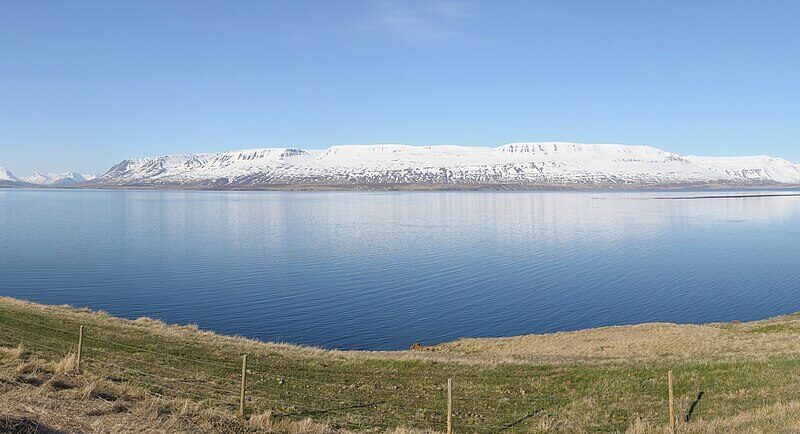
Eyjafjörður, among Iceland’s longest fjords, runs for 60 kilometres and widens to 15 kilometres at its broadest. Akureyri lies along its shore, while the valleys and lowlands in the area make it a key centre for Icelandic agriculture. Hrísey, Iceland’s third largest island at about 7.7 km², is located about 35 kilometres north of Akureyri. It has been inhabited since the earliest settlement of Iceland.
Kolbeinsey, at 105 kilometres from the mainland, is the northernmost point of Iceland. The islet, now reduced to two small skerries, has influenced the country’s fishing and economic zones. Öskjuvatn, within the caldera of the Askja volcano in central Iceland, is the country’s second deepest lake, reaching a depth of up to 217 metres. Its 11 km² expanse was created by volcanic events in 1875.
Öxarfjörður lies between Tjörnes and Melrakkaslétta. Sandur, the area south of the fjord, extends over approximately 300 km² and is shaped by silt from the glacial river Jökulsá á Fjöllum. Kópasker, located here, has a notable lamb-processing plant.
Askja is a stratovolcano complex in the central highlands, featuring several nested calderas. The 1875 eruption of Askja left about 5,000 km² covered in ash, driving a wave of emigration from Iceland. Öskjuvatn, within Askja, is predominantly covered in ice for much of the year.
Grjótagjá is a hot water-filled cave near Mývatn in Þingeyjarsveit municipality. It stands at 65.6272 N, 16.8817 W, not far from the volcanic and geothermal landscapes of the region.
Vatnajökull National Park, covering nearly 15,000 square kilometres or roughly 14 percent of Iceland, contains Vatnajökull glacier and was designated a UNESCO World Heritage Site in 2019.
Lake Mývatn, formed by basaltic eruptions 2,300 years ago, is rich in wildlife, supporting more duck species than any other lake in Europe. The terrain is dotted with pseudocraters and lava pillars shaped by steam explosions.
Local culture and museums
As well as the already mentioned Húsavík Whale Museum and The Exploration Museum, local history and stories are preserved at The Herring Era Museum in Siglufjörður, which tells the importance of the herring industry to Iceland’s economy, at one point providing up to 44 percent of export income. Siglufjörður was once called the ‘Atlantic Klondike’ during the peak years of the herring boom.
The Safnasafnið Icelandic Folk and Outsider Art Museum, located near Akureyri, opened in 1995. It displays around 150,000 items by over 300 artists, reflecting broad currents in Icelandic folk and outsider art, thanks to the efforts of Níels Hafstein and Magnhildur Sigurðardóttir.
Sources
- Wikidata
- Wikipedia (English)
- Wikipedia (Icelandic) in Icelandic
Image: Hansueli Krapf / Wikimedia Commons (CC BY-SA 3.0) · licence, original (resized) Illustrative image.
Facts last reviewed 18 October 2026. Published 19 October 2026.