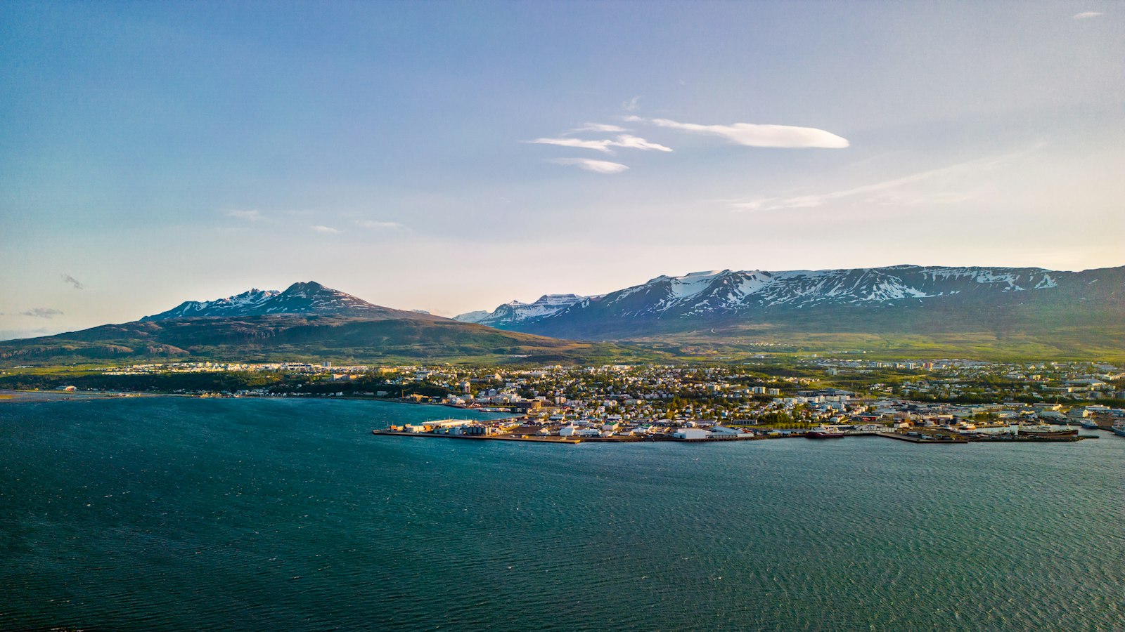
Akureyri sits at the inner end of Eyjafjörður in northern Iceland, just below the Arctic Circle. Its combination of a deep, ice-free harbour and fertile land has made it a regional centre for centuries. Today, as Iceland’s fifth largest municipality, and the biggest outside the capital region, Akureyri includes neighbourhoods beside the fjord, as well as the islands Hrísey and Grímsey.
From field to fjord: settlement and growth
The first permanent settler in the Akureyri area was Helgi magri Eyvindarson, whose arrival in the 9th century places the town’s origins in the early period of Icelandic colonisation. Despite this long history, the earliest known mention of Akureyri comes from 1562, in court records relating to a criminal case.
Danish traders arrived in the 1600s, drawn by the natural harbour and surrounding productive pastureland. Their trade focused on Icelandic wool and meat, but they did not live in Akureyri year-round, returning home over the winter. Permanent settlement only began in 1778, when the first residential house was built. The town’s status as a trading post was formalised with a municipal charter in 1786 by the Danish king, a strategy to encourage urban growth, which initially made little impact. For a long time, Akureyri’s population was tiny and its status as a town lapsed, then was restored in 1862.
A northern centre of trade, fisheries and learning
Akureyri’s fortunes turned as its excellent harbour and surrounding farmland supported population growth and economic development. The town was long associated with agriculture and trade, and it hosted a significant fishing industry from the twentieth century onwards. Two of Iceland’s largest fishing companies are now headquartered there. The port’s ability to remain ice-free year-round has been crucial for commerce.
During World War II, Akureyri served as a base for Allied air units, including Norwegian and British squadrons, protecting shipping routes across the North Atlantic. Its port was even included in German invasion plans that never came to pass. Following the war, Akureyri expanded as rural Icelanders relocated to towns and cities. Commerce, higher education, and hospital services have become increasingly important to the local economy. The University of Akureyri, founded in 1987, is growing swiftly and helps make Akureyri a “school town”.
Geography and local life
Akureyri occupies a narrow strip of land between steep hills and the calm waters known as Pollurinn, sheltered by mountains such as Strýta and Kerling. The Glerá river flows through the town, dividing the central area from Glerárhverfi, known locally as Þorpið, or the ‘Village’. Various districts form the urban landscape, from Innbær, the town’s oldest section, to Oddeyri, a distinct peninsula shaped by the river’s sediment.
Despite its high latitude, only about 100 kilometres from the Arctic Circle, Akureyri’s climate is characterised by relatively mild conditions, with less precipitation than southern Iceland and greater swings between summer and winter temperatures. The mountains offer protection from strong winds, letting the botanical gardens thrive outdoors. Snow covers the ground in winter and often lingers on the surrounding peaks throughout the year.
With a population of over 20,000 (as of 2026), Akureyri has expanded to include the islands of Hrísey and Grímsey. Hrísey, 35 kilometres north in the fjord, is a site for animal quarantine and former fishing processing, while Grímsey lies farther off the coast. The diversity of Akureyri’s residents has grown, with people from 53 different countries calling the town home by 2015.
Sources
- Wikipedia
- Wikipedia (Icelandic) in Icelandic


