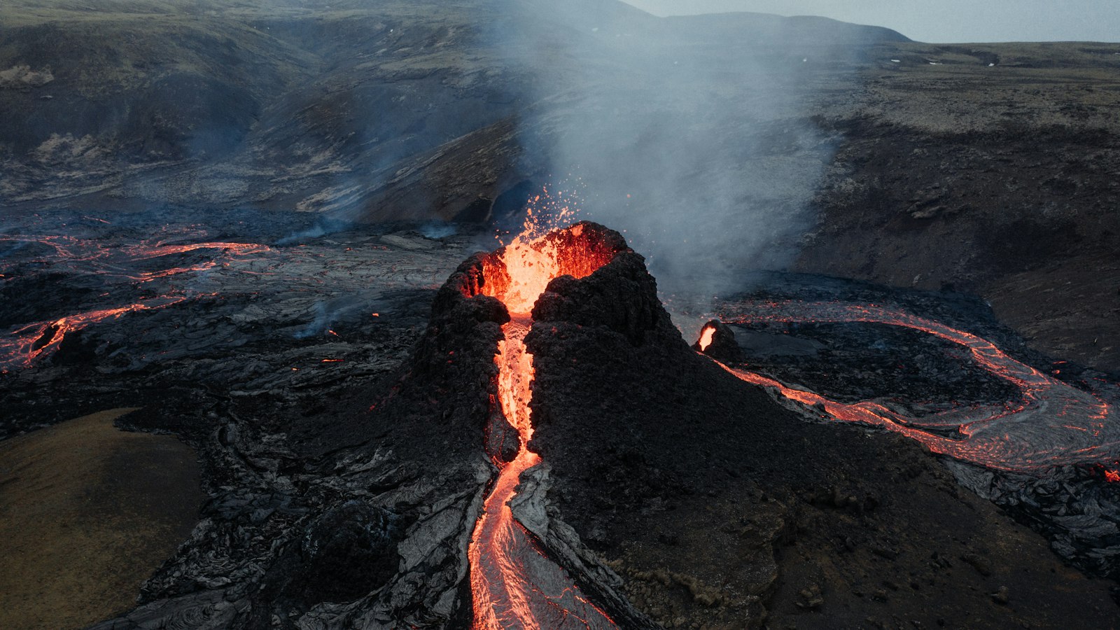
In southwest Iceland, a distinctive volcanic feature rises quietly above the landscape. Búrfell, pronounced [ˈpurˌfɛtl̥], and its accompanying channel Búrfellsgjá, are well-known landmarks approximately seven kilometres from Hafnarfjörður, on the edge of Reykjavík’s urban sprawl. These form part of the Krýsuvík volcanic system on the Reykjanes peninsula, one of Iceland’s most volcanically active regions.
A solitary spatter cone
Unlike the chain of cones that characterises much of the Reykjanes volcanic terrain, Búrfell is an isolated, monogenetic volcanic cone, a rare formation in this area. Towering 80 metres above its surroundings, it stands alone on a foundation built from older Tertiary basalt lavas. Scientists debate the age of Búrfell’s eruption, with proposals ranging from around 7300 years ago to over 8000 years, placing its main activity long before the earliest settlement of Iceland.
During its eruptive phase, Búrfell’s circular crater, roughly 60 to 140 metres wide, contained a lava lake. Lava fountains built ramparts of spatter around its edge. The flowing lava produced not only the mountain but also one of the peninsula’s largest lava fields, Búrfellshraun.
Following flows and fractures
Búrfellshraun covers an estimated 18 square kilometres and extends as far as 12 kilometres from its source. Volumes are assessed between 0.36 and 0.5 cubic kilometres, though subsequent eruptions have buried parts of the original lava in places such as Straumsvík. At the time of the eruption, sea levels were some 10 metres lower. Today, parts of the ancient flow lie hidden beneath water in the fjords of Skerjafjörður and Hafnarfjörður.
The lava travelled in several major branches, reaching the sea in different directions and earning local names such as Urriðakotshraun, Vífilsstaðahraun, and Gálgahraun. The moving lava carved out long channels, the most prominent is Búrfellsgjá, a preserved gutter running 3.5 kilometres northwest from the crater. Other channels, such as Lambagjá and Kringlóttagjá, show how the eruption adapted to regional topography and the complex network of faults in the Reykjanes system.
Towering faults and fractures add drama to the terrain around Búrfell, especially at the Hjallar fault scarp. The intersection of these fractures and lava flows has created a distinctive topographical depression, or graben, stretching from Krýsuvík to Úlfarsfell.
Beneath the Búrfellshraun surface, explorers have described lava tubes such as Þorsteinshellir and Selgjarhellir, where molten rock once continued its journey below ground. Where the lava channel widens, especially in Selgjá, the sheltering overhanging cliffs were once valued as refuges for sheep during storms. Remnants of old farming structures at their base recall how people adapted to this landscape.
This entire area, falling within Garðabær municipality, was officially designated as a protected natural monument in 2020, highlighting its scientific value and role in regional identity.
Sources
- Wikipedia
- Wikipedia (Icelandic) in Icelandic


