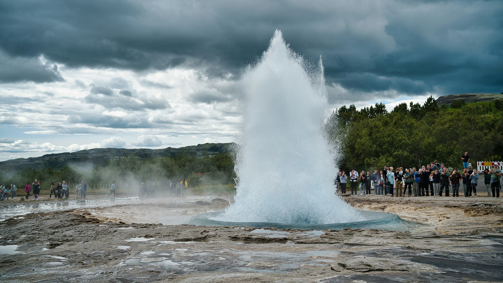
Haukadalur, meaning “valley of hawks” in Icelandic, is a shallow, low-lying valley in southern Iceland, about 110 kilometres northeast of Reykjavík. Set in the Bláskógabyggð municipality, its elevation stands at roughly 100 metres above sea level. The valley stretches to the north of Laugarvatn lake and is known for a combination of striking geology, early Icelandic history, and one of the country’s national forests.
The geothermal wonders of Haukadalur
Most visitors first hear of Haukadalur because of its geothermal area, aligned north to south for about six kilometres along the eastern side of the Laugarfjall rhyolite dome, which rises 187 metres above the valley floor. This zone is packed with hot springs, mud pots and hissing fumaroles, and is best known as the home of two major geysers. The original “Geysir”, from which the English word ‘geyser’ is derived, lies here. Today, Geysir erupts rarely, often dormant for years, though its neighbour Strokkur provides frequent eruptions every four to ten minutes. More than forty other smaller geothermal features dot the landscape, making the whole area a natural laboratory of geothermal activity.
The source of this relentless underground heat may lie 50 kilometres north in the southern reaches of the Langjökull ice sheet, which feeds the groundwater deep below before it resurfaces as scalding springs. Written sources first mention Haukadalur’s geysers as early as 1294, noting how earthquakes had activated new hot springs. The link between seismic activity and eruptions continues in modern times: earthquakes on 17 and 21 July 2000 were known to reactivate local geysers. Long before modern tourism, the valley’s springs attracted visitors, and by the 18th century, Haukadalur was already renowned as a destination.
A valley of forests and medieval chieftains
Haukadalur is also important for its woodlands. The Haukadalsskógur National Forest covers part of the valley, contributing to the mix of steaming geothermal earth and thriving plant life. Not far from these woods stands Haukadalskirkja, a church with a long history in the valley.
The valley’s name also lives on through the Haukdælir, a powerful family clan from the 9th to 13th centuries. Among their descendants were the historian Ari Þorgilsson, the chieftain Gissur Þorvaldsson, and several bishops, marking Haukadalur as a region with deep historical roots.
Geologically, Haukadalur is framed by ancient volcanic remnants. The hyaloclastite ridge of Bjarnarfell, to the west, rises to 727 metres and consists mainly of basalt with some rhyolite. Sandfell, a shield volcano reaching 610 metres in the north, forms a distinctive feature on the horizon. These volcanoes have not erupted for over 10,000 years.
Nearby, the Gullfoss waterfall thunders 10 kilometres north in the direction of Iceland’s highlands. Alongside Gullfoss and Þingvellir, Haukadalur forms part of the frequently visited Golden Circle route, celebrated for its unique interaction between geology and Icelandic history.
Sources
- Wikipedia
- Wikipedia (Icelandic) in Icelandic


