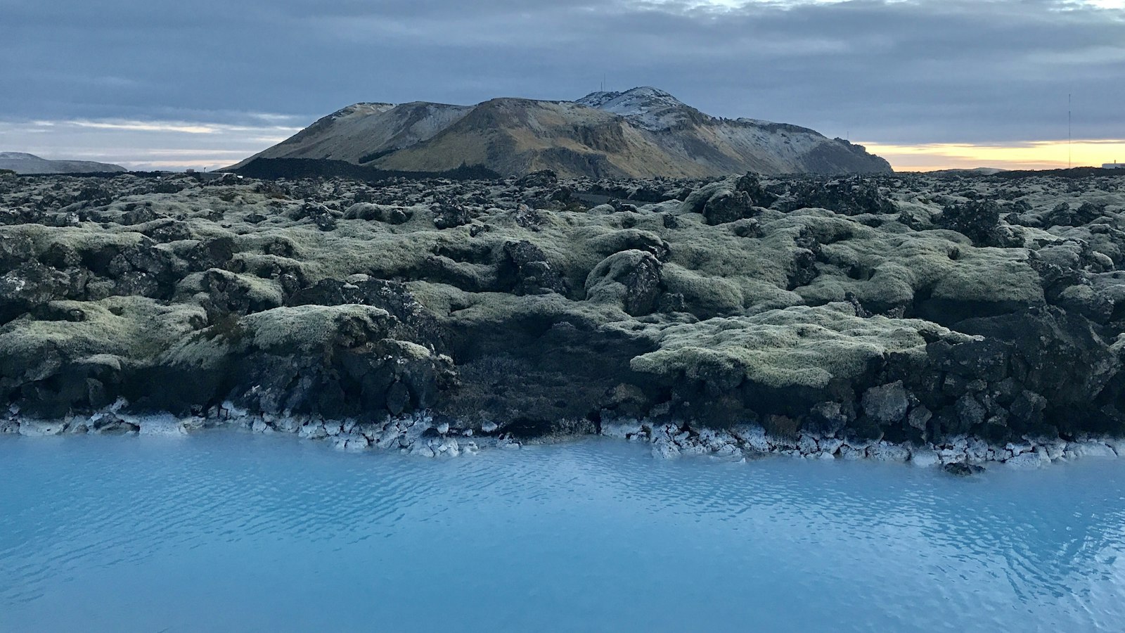
Just north of the coastal town Grindavík on Iceland’s Reykjanes peninsula stands Þorbjörn, a 243 metre high volcanic mountain. Unlike many of its neighbours, whose slopes formed above sea level, Þorbjörn is a product of violent eruptions beneath thick Pleistocene glaciers. Today, this flat-topped feature, known in Icelandic as a tuya, is both a symbol of the region’s geology and a silent record of the forces shaping southwest Iceland.
A mountain born under ice
Þorbjörn’s origins can be traced to glacial times, when lava erupted into a world locked in ice. As magma rose beneath glaciers, it built up a meltwater lake, solidifying rapidly to create layers of volcanic rock known as pillow lavas. Continued eruption formed a broad, flat crest, but erosion has since worn away any visible traces of subaerial lava flows. Though its slopes are interrupted by faults, including an 80 metre deep canyon (Þjófagjá), researchers attribute the bulk of Þorbjörn’s shape to a single eruptive event.
The mountain stretches in line with the volcanic fissure systems that define Reykjanes, an area marked by frequent seismic shifts. To its northwest, Holocene lava fields and geothermal activity at Svartsengi reflect the ongoing influence of the Mid-Atlantic Ridge, which comes ashore in this region. Near Þorbjörn sits the famous Blue Lagoon; from the summit, its pale waters are easy to spot.
History and folklore meet geology
Þorbjörn is woven into local tales. Its name recalls a local farmer’s son who, according to legend, infiltrated a group of bandits hiding in a canyon within the mountain. After discovering their lair, the young man exposed the thieves, who were captured and hanged at a nearby site called Gálgaklettar. The canyon remains known as Þjófagjá, or “Thieves’ Canyon.”
The mountain’s accessible slopes have also played a modern role. During World War II, the US Army built a jeep track up Þorbjörn, which still exists today. The summit now hosts radio and television transmitters on the site once used by a US Navy radar station. These installations became Icelandic property in 2006 when the Navy withdrew.
Even now, Þorbjörn remains a focus for scientific monitoring. Beginning in 2020, ground instruments recorded swarms of small earthquakes and several episodes of ground uplift, events linked to magmatic intrusions at depths of three to four kilometres near the mountain. More than 8,000 earthquakes were measured from January to April 2020, the most significant activity recorded in the region since instruments were first installed. The Reykjanes peninsula is no stranger to such unrest; its last major eruptive period was the Reykjanes Fires from 1220 to 1240.
For the people living in Grindavík’s shadow, Þorbjörn serves as a reminder of both ancient stories and the ever-active ground beneath their feet.
Sources
- Wikipedia
- Wikipedia (Icelandic) in Icelandic


