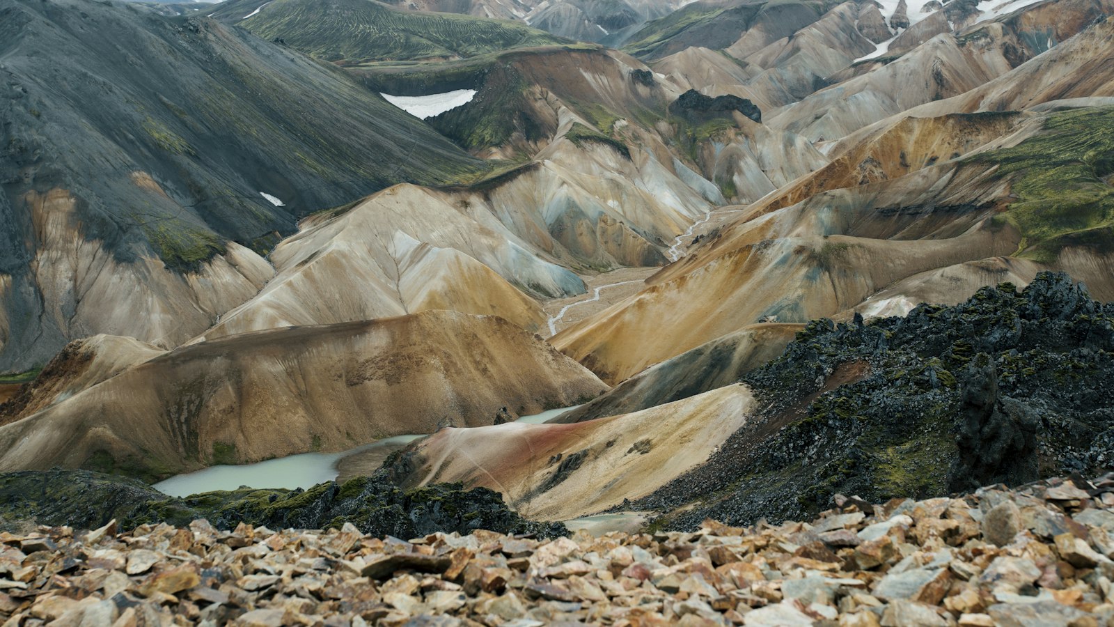
Deep within Iceland’s highlands, beyond the roads that freeze over in winter, lies Landmannalaugar. This area, whose name means “the people’s pools,” sits at the edge of the Laugahraun lava field, an expanse formed by an eruption in approximately 1477. Today, it is celebrated not just for its natural geothermal hot springs but also for the multi-coloured rhyolite mountains that signal the region’s volcanic past.
Landmannalaugar is part of the Fjallabak Nature Reserve, an area where geothermal energy shapes the land in visible and practical ways. The location stands around 600 metres above sea level, with the main hut positioned at the edge of the ancient lava field. These huts date back to 1951, though the current structure largely originates from 1969, serving as a crucial shelter for people passing through the area during the brief highland summers.
A landscape shaped by fire and water
The landscape surrounding Landmannalaugar is a direct result of its place on one of Iceland’s most active geothermal zones, the Torfajökull area. Heat from below ground creates not only the well-known hot springs but also produces dramatic colour contrasts in the mountains. Rhyolite, obsidian and other volcanic rocks reveal reds, blues and blacks just beneath the surface, a mark of centuries of eruptions and cooling.
The area’s natural geothermal pools have long been a feature of human activity here. Traditionally, weary travellers and their horses would pause at Landmannalaugar to bathe and recover in the hot water, continuing a custom that still shapes the site’s identity.
Trails across the highlands
Landmannalaugar serves as the northern end of the Laugavegur trail, perhaps Iceland’s most celebrated multi-day trek. Hikers pass through places such as Hrafntinnusker, Álftavatn, Hvanngil and Emstrur before reaching Þórsmörk. Some journeys extend over the Fimmvörðuháls pass, bridging Eyjafjallajökull and Mýrdalsjökull glaciers and ending in Skógar.
For those interested in shorter walks, nearby hiking routes include the trail through the Laugahraun lava to Brennisteinsalda (known as the Sulphur Wave), the climb up Bláhnjúkur (“Blue Peak”), and the longer route to the crater lake called Ljótipollur, meaning “Ugly Puddle.” Icelandic horse riding has also been a tradition here in summer, with routes offering access to remote valleys such as Jökulgil (Glacier Valley), areas otherwise unreachable by car or foot. Winter brings opportunities for cross-country skiing, while fishing for arctic char is a common pursuit in the region’s lakes and rivers.
Recent years have seen increased attention to preserving Landmannalaugar’s environment. Due to a rise in car traffic and congestion in summer months, a parking reservation system has been introduced, limiting vehicles between 8 AM and 3 PM and aiming to protect the fragile highland landscape.
Sources
- Wikipedia
- Wikipedia (Icelandic) in Icelandic


