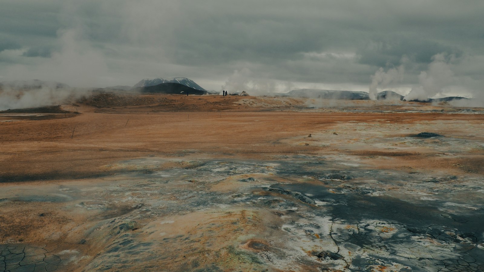
Far from the coasts and within Iceland’s central highlands, Hveravellir stands out as one of the country’s roughly 30 high-temperature geothermal areas. Resting at 600 to 650 metres above sea level, the site is situated at the Kjölur route between two prominent glaciers: Hofsjökull and Langjökull. The geothermal field belongs to the Oddnýjarhnjúkur-Langjökull volcanic system, and its activity is witnessed in the mix of hot springs, small geysers, fumaroles, boiling pits and warm spring pools scattered across an expanse of roughly 2.5 square kilometres.
The landscape here is anything but uniform. Sinter and geyserite, the silicate-rich mineral deposits thrown up by the springs, form broad domes and crusts that mark both active centres and now-dormant vents. Noteworthy features include the dominant Kjalhraun lava shield on the southern edge and several named springs such as Öskurhóll, Bláhver, and Eyvindarhver. Some geysers remain mildly active, with irregular small eruptions rather than the dramatic displays sometimes found elsewhere.
Central highland refuge and route
Hveravellir’s unique setting and geothermal warmth made it a valuable stopover for those travelling the Kjölur route across Iceland’s interior. Since Iceland’s earliest centuries of settlement, the location was well known as a resting point and is frequently referenced in the medieval sagas, annals and folklore. Remnants of past occupation linger: in the 18th century, the outlaw Fjalla-Eyvindur and his wife Halla are said to have found shelter here, with ruins including Eyvindarkofi (Eyvindur’s hut) and primitive cooking sites using the hot springs as natural stoves.
Efforts to provide shelter for travellers have a long history. A turf and stone refuge hut (sæluhús) was built in 1922, renewed in 1994, and the Icelandic Touring Association erected one heated by geothermal water in 1938, one of the few such huts in Iceland. Both structures remain in use. In addition to shelter, the area attracted curiosity and scientific attention: the oldest description dates from 1752, authored by Eggert Ólafsson and Bjarni Pálsson.
Traditions and observation
Local customs make use of the geothermal power. On Breiðimelur, north of the central field, people have long baked black rye bread by burying it in steam vents, drawing on centuries-old techniques tied to Iceland’s subarctic conditions and resourcefulness.
Meteorological records are another legacy. Iceland’s weather service maintained a manned observation station at Hveravellir from 1965 until conversion to automated observation in the 21st century, enabling close study of climate in the highlands for decades.
The geothermal field at Hveravellir, rich in minerals, history and living traditions, offers a window into how nature and people have adapted side by side for more than a millennium.
Sources
- Wikipedia
- Wikipedia (Icelandic) in Icelandic


