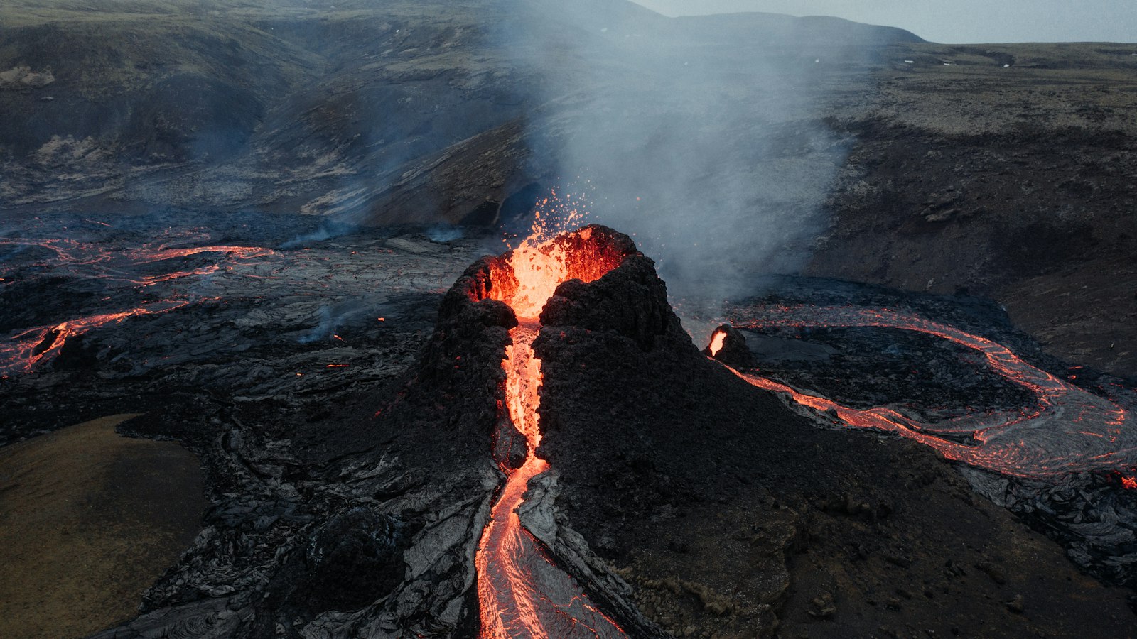
Holuhraun, pronounced [ˈhɔːlʏˌr̥œyːn], is one of Iceland’s most prominent lava fields, dramatically situated just north of the vast Vatnajökull ice cap in the highlands of northeastern Iceland. Its stark landscape captures the intense volcanic forces that have shaped the country over centuries, and recent history in particular.
A region shaped by fire and ice
The Holuhraun lava field lies in Suður-Þingeyjarsýsla, in a region where some of Iceland’s biggest volcanoes intersect. Its location at the southern edge of the broader Ódáðahraun, one of the largest lava deserts in Iceland, is flanked by distinctive geological features such as the Dyngjujökull glacier to the south and mountains like Hrímalda, Urðarháls, and Kistufell to the west. Not far to the north is the Askja caldera, while Bárðarbunga volcano sits to the southwest.
Beneath this landscape, fissure systems belonging to both Bárðarbunga and Askja run toward each other. Holuhraun sits at the interface of these systems, making it a focus for volcanic activity. The ground here is layered with lava flows and volcanic sediments, the record of countless past eruptions. The main flow of the Jökulsá á Fjöllum river, one of Iceland’s largest glacial rivers, skirts across the region, bringing meltwater from the surrounding glaciers.
The 2014–2015 eruption and its legacy
Although an older Holuhraun existed here, the most dramatic transformation occurred in late August 2014. After a notable earthquake swarm began around Bárðarbunga volcano in mid-August, magma tracked progressively northwards. This culminated in a brief but significant fissure eruption in Holuhraun just after midnight on 29 August, followed by a larger, far more sustained eruption commencing in the early hours of 31 August.
The main eruptive fissure quickly extended to about 1.5 kilometres and produced fountains of lava that rose up to 100 metres. Over the following months, the eruption continued at a steady pace. By September, the new lava flow had reached the Jökulsá á Fjöllum and grown rapidly in size. The eruption ended on 27 February 2015, by which time the newly-formed Holuhraun lava field covered more than 85 square kilometres with a volume of around 1.6 cubic kilometres, making it Iceland’s largest lava field since the Laki events of 1783.
No significant ashfall was reported during this eruption, but the event was closely watched locally and internationally. Several possible new names were considered for this vast new landscape, including Flæðahraun and Nornahraun, but ultimately the established name Holuhraun was kept, reflecting the site’s geological continuity.
Today, Holuhraun remains a stark recent reminder of how swiftly Iceland can be reshaped by the convulsions of the earth beneath the Vatnajökull ice cap. Its jagged edges and still-cooling rock are a testament to the ongoing power of Iceland’s volcanoes.
Sources
- Wikipedia
- Wikipedia (Icelandic) in Icelandic


