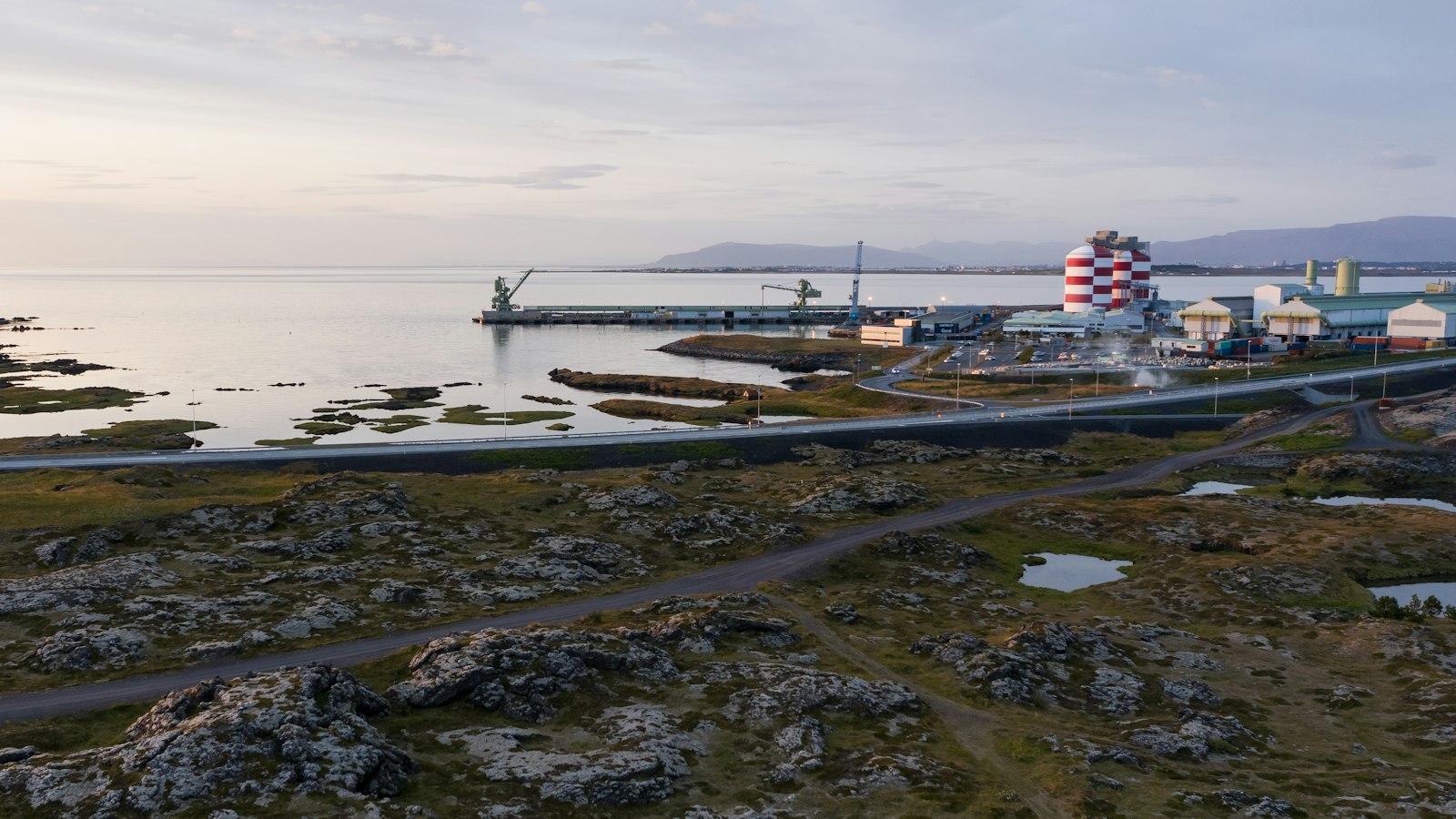
Running approximately 30 kilometres along Iceland’s western coast, Hvalfjörður (“whale fjord”) sits between the municipalities of Mosfellsbær and Akranes. Its waters stretch about 5 kilometres across, bordered by a landscape rich in both natural and human history.
Naming mysteries and folklore
How Hvalfjörður got its name is a question with several possible answers, each reflecting a different slice of Icelandic culture. Although its modern era whaling station is the only one in Iceland, and whaling itself takes place at sea beyond the fjord, today no whales swim in these waters. Some speculate that early settlers found stranded whales here, a windfall for struggling communities who called such events by the dual-meaning word ‘hvalreki’. Another possibility is that the fjord simply takes its name from Hvalfjall (“Whale Mountain”), a peak notable at the fjord’s end, whose shape might loosely suggest a whale’s form. Myth clings to the area as well, with local tales of an elf woman transforming her spurned lover into a vengeful red-headed whale called Rauðhöfði, destined to haunt the fjord’s waters.
Layers of history and livelihood
Hvalfjörður is woven into Iceland’s past and present, from epic sagas to volatile modern industries. In the Age of the Sturlungs, the small steep island Geirshólmi near the fjord’s northwest sheltered outlaws, at one point including Svarthöfði Dufgusson, who launched raids on neighbouring farms. Nearby, Grundartangi is now Iceland’s home for major industries, including an aluminum smelter and silicon plant, with one of the island’s largest harbours.
During the Second World War, the Allies used the fjord’s natural harbour for a naval base. British and American forces had headquarters and piers here, and vessels carrying supplies between North America and the Soviet Union paused at anchor. Some of the wartime buildings survive as relics of Iceland’s 1940s military chapter. Today, one dock built by the American Navy now serves the local whaling company, which processes mainly fin whales for domestic use and export.
Nature has always marked Hvalfjörður as well. Two rivers named Fossá run through the southern side, each with its own set of cascades, and the Laxá river (salmon river) crosses near Kjós, in the south. At the innermost reach, volcanic peaks meet summer-green forests, including birch and planted conifers. The remarkable Glymur waterfall, formerly Iceland’s tallest, tumbles through a gorge that can be accessed by a hiking trail starting at the fjord’s end.
Until the close of the twentieth century, anyone travelling between Reykjavík and Borgarnes by road had to go the long way round, 62 kilometres along the main ring road. The 1998 opening of Hvalfjarðargöngin, a tunnel running nearly 5,800 metres under the fjord, drastically shortened the journey, allowing easier access for those venturing west.
Sources
- Wikipedia
- Wikipedia (Icelandic) in Icelandic


