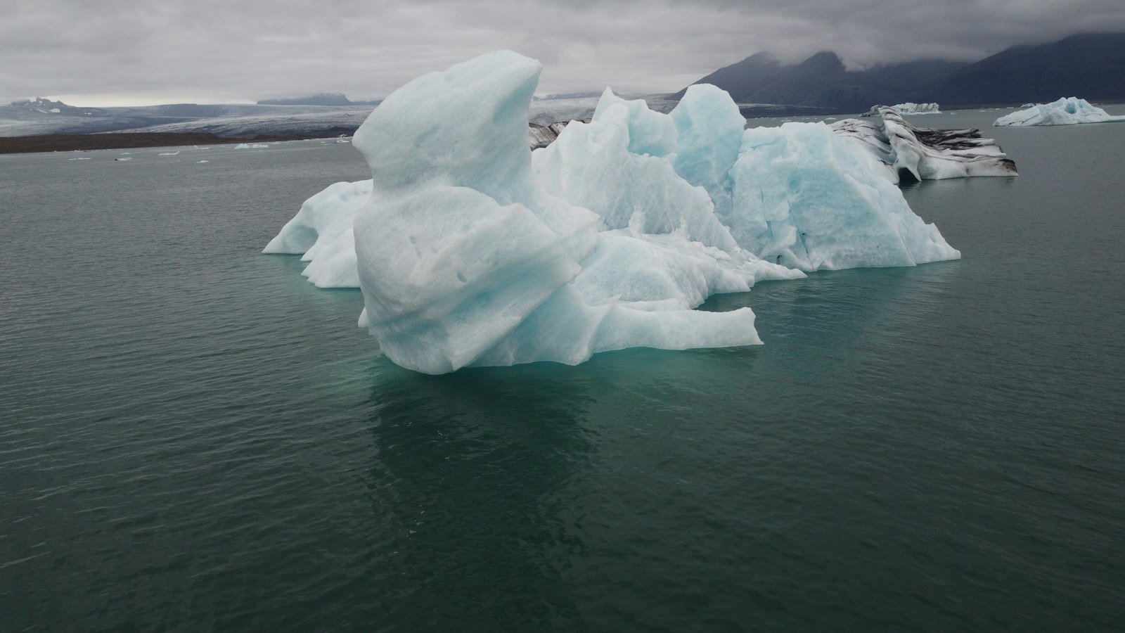
Jökulsárlón, meaning “glacial river lagoon,” is a lake where earth, ice, and ocean interact in a dramatic and ongoing transformation. Located at the southeast edge of Vatnajökull National Park in Iceland, it sits beside the tongue of the Breiðamerkurjökull glacier. This area traces the modern story of glacial change, as ice ebbs and flows, shaping the very outline of the land.
The ever-changing lagoon
The lagoon is a recent addition to Iceland’s geography. Jökulsárlón began forming after Breiðamerkurjökull started to recede at the end of the Little Ice Age, a cold period between 1600 and 1900. The main push backwards, though, came in the early twentieth century as rising temperatures drove the glacier to retreat at an average rate of around 200 metres per year. Where there was once solid ice, meltwater filled a long, deep depression carved by the advancing glacier centuries earlier.
Today, Jökulsárlón covers about 25 square kilometres and is Iceland’s deepest lake, dropping more than 284 metres down. Its surface is a shifting mosaic of icebergs, some up to 30 metres high, that calve from the glacier’s edge. These icebergs come in bright blue or milky white shades, colours determined by the mix of light and air trapped within the ice. Sometimes, black streaks of volcanic ash, remnants of older eruptions, can be seen in the frozen masses.
The lagoon connects to the Atlantic through a short river, and saltwater at high tide seeps into the lake. This process causes the submerged parts of the icebergs to melt more rapidly than the exposed ones, often making the bergs unstable so they roll over in the water, revealing a new, temporarily pristine face that may glow vivid blue before sunlight turns it white.
A habitat in transition
Unlike most glacial lakes in Iceland, Jökulsárlón teems with life. Fish including herring and capelin enter the lagoon from the sea when tides allow. Seals gather in considerable numbers at the river mouth, especially in winter as they hunt for fish. On the nearby outwash plains known as Breiðamerkursandur, Arctic terns, Arctic skuas and other seabirds nest during the summer, drawn by the seasonal abundance. Even reindeer have occasionally been seen near the eastern edge.
The flora beside the lake is hardy and sparse, with lichens, mosses and tough grasses rooting in soil that was, in many spots, under ice just decades ago. Discoveries of ancient tree remains suggest that the present outwash plain was once much richer in vegetation before glaciers expanded during colder centuries, the very origin of the name “Breiðamörk” points to a wooded land.
Legacy and preservation
Jökulsárlón and its surroundings were brought under protection in 2017 as part of Vatnajökull National Park, a UNESCO World Heritage Site since 2019. At nearly 15,000 square kilometres, the park covers about 14% of Iceland and is recognised for the interplay of glaciers, rivers, volcanoes and geothermal features that create an extraordinary landscape. Jökulsárlón sits just off Route 1, between the towns of Höfn and Skaftafell, with the Ring Road crossing the river at the lagoon’s outlet. The sand beaches nearby, called Eystri-Fellsfjara, are scattered with glistening chunks of ice, sometimes nicknamed “diamond beach.”
As the glacier continues to retreat, scientists predict that the lagoon will keep growing, perhaps one day becoming a deep fjord reaching to the roots of the Esjufjöll mountains. In every season, Jökulsárlón stands as a living record of climate, natural forces and the relationship between land and water on Iceland’s shifting southern coast.
Sources
- Wikipedia
- Wikipedia (Icelandic) in Icelandic


