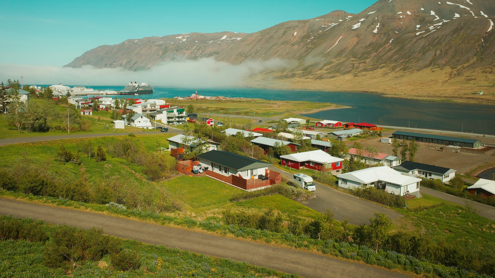
Bolungarvík is the northernmost settlement on the southern side of Ísafjarðardjúp, the large fjord in northwest Iceland. Today, it is the only town in its municipality, set against steep mountains and surrounded by dramatic natural features. With approximately 1,000 residents, Bolungarvík is now the second-most populous town in the Westfjords, following Ísafjörður, which lies just a short distance to the southeast.
This village has been tied to the sea for centuries. Its proximity to fertile fishing grounds made Bolungarvík one of Iceland’s earliest fishing outposts. By the 17th century, up to 30 boats would set out from here, swelling to nearly 90 around 1900. The local fishing season employed many, with fishermen based in temporary camps known as ‘verbúðir’. Unlike in other fjord communities, these camps never grew into a permanent fishing hamlet, but their presence shaped Bolungarvík’s early growth and identity.
From isolation to connection
Until the mid-20th century, reaching Bolungarvík from the rest of Iceland was difficult. The only route ran along Óshlíð, a dangerous cliff-side path below the mountain Óshyrna. Avalanches, rockfalls and coastal erosion made this road treacherous, and in winter, travel was sometimes only possible by walking along the shore. The first drivable road was completed in 1950, but it was not until 2010 and the opening of the Bolungarvíkurgöng tunnel that the village was finally linked year-round by a safer route through the mountain to Hnífsdalur and Ísafjörður.
The landscape around Bolungarvík is marked by steep mountains. The prominent Traðarhyrna peak rises behind most of the town, carrying a risk of avalanches in winter. To protect the community, snow barriers named Vörður and Vaki have been built. Nature remains a powerful neighbour, shaping both the environment and daily life here.
Settlers, spells and stories
The area was first settled around the year 940, according to Iceland’s ancient Book of Settlements (Landnámabók), by Þuríður Sundafyllir and her brother Þjóðólfur. Local folklore tells that the siblings fell out and, both being skilled in magic, placed curses on each other. Þjóðólfur was doomed to exist forever as a bird-fouled monolith; Þuríður was destined to stand where the wind always blew. The landmark rock said to be Þuríður collapsed in 1936, and legend has it that on that same night, Þjóðólfur’s sea cliff vanished beneath the waves.
Today, Bolungarvík’s heritage remains visible in multiple forms. The historic Ósvör site on the town’s edge is a restored fishing camp and museum, reflecting the conditions 19th-century workers endured. The town’s connection to the wider landscape is also visible at nearby Bolafjall, a 638 metre mountain, accessible by a gravel road in summer and offering expansive views of Ísafjarðardjúp, the Jökulfirðir, and over the water to the Denmark Strait.
Through its history and landscape, Bolungarvík continues to represent the resilience and traditions of Iceland’s Westfjords communities.
Sources
- Wikipedia
- Wikipedia (Icelandic) in Icelandic


