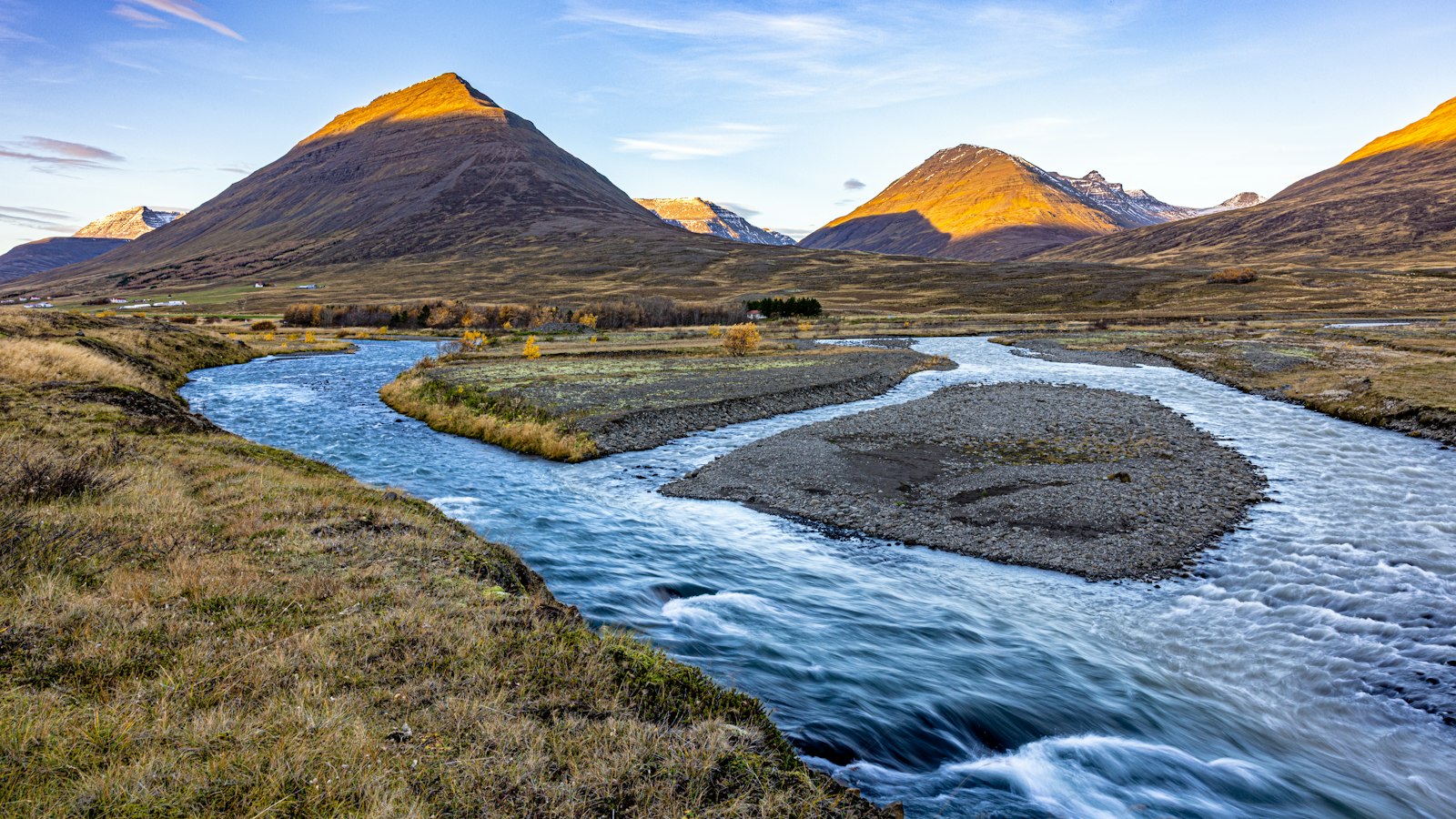
In the eastern reaches of Skagafjörður, the valley of Norðurárdalur (North River Valley) reveals a landscape shaped by centuries of land use, weather and rivers. The valley forms a natural boundary with the neighbouring district of Blönduhlíð, marked by the course of the Bóluá river. Today, Norðurárdalur is threaded by Iceland’s main highway, Route 1, as it rises toward the plateau of Öxnadalsheiði, connecting history, settlements and nature.
Geography broken by rivers and mountains
Norðurárdalur first stretches east-southeast before curving northeast, its contours defined by a striking arrangement of mountains and watercourses. At the mouth near the Bólugil ravine, the north side climbs into Silfrastaðafjall mountain. Further along, the land is known as Kotaheiði, extending to the Valgagilsá river, then opening onto Silfrastaðaafréttur, a traditional highland pasture. As the land rises, features like Krókárgerðisfjall and Borgargerðisfjall mountains line the southern horizon, with Virkishnjúkur peak guarding the valley’s far end. Tributary valleys feed into Norðurárdalur, one side forming part of Egilsdalur valley, the other crossing into Tungudalur, before dissolving into a region called Kjálki.
The valley floor alternates between patches of lowland and sandbanks, particularly in the middle where the Norðurá river meanders in wide, winding bows. The Norðurá has gathered the flow of several tributaries, Kotaá, Valagilsá, Króká, and Egilsá rivers, each of which helped define where people could cross, settle, and farm. Before bridges, certain rivers, especially Valagilsá, were major obstacles to travel and transport.
Farms, landslides and new forests
At its most populated, seven farms dotted Norðurárdalur. In recent memory, only three, Silfrastaðir, Fremri-Kot, and Egilsá, are inhabited. The rest, including Borgargerði and Ytri-Kot, were abandoned gradually from the late 19th to the late 20th century, as changes in rural life and natural hazards took their toll. A heavy rainstorm in July 1954 caused significant landslides, one coming to a standstill just above the dwelling at Fremri-Kot, while another struck the already deserted Ytri-Kot.
Egilsá farm was left empty in 2009 but occupied again the next year. It has served not only as a residence but also as a summer home for children and later as a boarding school for teenagers with disabilities, showing how rural properties can be repurposed through the generations.
One recent chapter in Norðurárdalur’s story is the extensive reforestation at Silfrastaðafjall mountain. Over the past years, more than a million trees have been planted here, an uncommon scale in a country mostly known for its sparse forests. Replanting efforts have combined the valley’s often favourable weather with a wish to restore lost woodlands and reshape the future landscape.
This interplay of rivers, mountains, abandoned and living farms, and the steady arrival of young forests marks Norðurárdalur as a living example of Iceland’s shifting countryside.
Sources
- Wikipedia
- Wikipedia (Icelandic) in Icelandic


