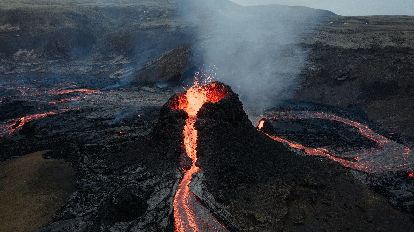
Only 25 kilometres from Reykjavík lies Eldborg í Bláfjöllum, a volcanic cone shaped by eruptions that took place over a millennium ago. This scoria cone is the central figure among three small volcanoes in the Bláfjöll mountains, a location where geology and local tales come together just a short drive from Iceland’s capital.
A volcanic legacy in the Bláfjöll region
Eldborg í Bláfjöllum rose from the earth around the year 1000, part of a cluster of craters and lava flows connected to the Brennisteinsfjöll volcanic system. Surrounding the cone are striking lava channels and tubes left as physical evidence of this volcanic episode. The name ‘Eldborg’ translates as ‘fire castle’, hinting at the crater’s dramatic origins and visual presence in the area.
The cone is located about 2 kilometres from the well-known Bláfjöll skiing area, a region otherwise popular for its winter sports. Route 407 to the ski area passes by the crater, placing this geological site on the path for those travelling to or through the region in any season.
Protected nature and royal names
Since 1971, Eldborg and its wider surroundings have been designated a protected natural monument inside Bláfjalla Fólkvangur, which restricts all activity to marked hiking trails and prohibits any driving or construction without strict permission. The protected area stretches from the road Bláfjallavegur over the mountain ridge of Drottning and back, covering 34.8 hectares.
Not far from Eldborg, two notable subglacial mounds called Stóra-Kóngsfell and Drottning break the landscape. These were formed when eruptions met thick glaciers during the last ice age. Stóra-Kóngsfell, meaning ‘Big King’s-Mountain’, reaches 602 metres, while Drottning, meaning ‘Queen’, stands at 410 metres. Their royal titles recall a time when this highland area was linked to royal farmland holdings in nearby valleys. While the larger mound’s name stems from these royal associations, the smaller was at first known to locals as Litla-Kóngsfell (‘Small King’s-Mountain’), but skiers popularised the name Drottning, which later became official.
A network of hiking trails, including links to the well-known Reykjavegur Hiking Trail, winds through the vicinity. In winter, the region becomes a place for cross-country skiing, though all visitors must stay on marked paths to preserve the fragile landscape shaped by fire and ice.
Sources
- Wikipedia
- Wikipedia (Icelandic) in Icelandic


